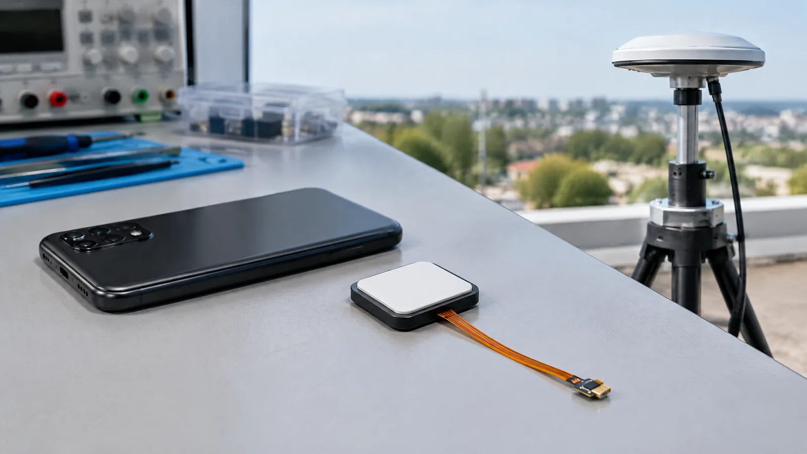
When your blue dot takes time to settle outside a station or jumps beside a tall building, the GNSS receiver and antenna in your phone are working with difficult signals rather than reading location from one simple sensor. The GNSS receiver and antenna listen to timing signals from navigation satellites, then software combines those measurements with other clues to estimate where you are.
This article is part of the computer hardware technology guide library.
What is a GNSS receiver in a phone?
GNSS means Global Navigation Satellite System. GPS is the US system within that broader group; phones may also use systems such as Galileo, GLONASS, BeiDou or QZSS when the hardware and software support them. The receiver is a radio system that processes satellite signals. The antenna is the part that couples those signals into the phone’s radio hardware.
This is an important terminology point: the GNSS receiver and antenna are not the same as an Android physical sensor such as an accelerometer or gyroscope. Android can expose raw GNSS measurements through its location framework, but the underlying job is radio reception and timing analysis. A phone then turns those measurements into a position, speed and time estimate for apps such as Maps or a fitness recorder.
- The antenna receives very weak satellite radio signals.
- The GNSS chipset tracks signals and measures their timing and other properties.
- Location software estimates position and may combine it with Wi-Fi, cellular or motion information.
- An app receives a location result, not a guarantee that satellite-only positioning was used for every update.
How does a phone calculate GPS location?
Navigation satellites transmit signals that contain precise time information and orbital data. The receiver compares when a signal was sent with when it arrived. That difference gives an estimated distance, commonly called a pseudorange because receiver-clock error and other effects are included. Measurements from several satellites let the positioning engine solve for the phone’s location and its clock offset.
The result is not a photograph of the phone’s position. It is a computed solution whose quality depends on signal geometry, timing, antenna performance, interference and the quality of the available measurements. In a clear outdoor view, more usable satellite signals can help. Indoors, under dense cover or beside reflective buildings, signals can be blocked or reflected and the estimate may take longer or become less stable.
Android’s raw GNSS documentation describes fields such as pseudorange, pseudorange rate, navigation messages and carrier-phase-related measurements. These fields are optional and vary by chipset. Most users do not need raw logs, but the distinction explains why two phones can expose different GNSS capabilities even when both show a GPS icon.
Why the antenna matters as much as the receiver
A capable receiver still depends on the radio-frequency path around it. The antenna’s placement, tuning, orientation and nearby materials affect how well the phone receives satellite signals. A compact handset also contains cellular, Wi-Fi, Bluetooth, NFC and other radios, so designers must fit the GNSS path into a crowded device without assuming every model will behave the same way.
Android 11 and later can provide model-level antenna information through `GnssAntennaInfo`, including phase-centre offset, phase-centre variation and signal-gain corrections. That does not mean an owner can turn any phone into a survey instrument. It means compatible software can account for characteristics documented for that device model when working with measurements.
Cases, hand position and the surrounding environment can change the radio conditions. A thick or poorly designed accessory may affect reception, but a weak location result is not proof that the case is the cause. Check the same route in a more open place and compare the phone’s displayed behaviour before drawing a conclusion.
Dual-frequency GNSS, multiple constellations and assisted location
Some phones can track more than one frequency, such as the L1 and L5 bands, while others cannot. Multi-frequency support is model- and chipset-dependent. It can give the positioning engine more information to work with, but the label alone does not promise a fixed accuracy in every street, building or weather condition.
Multiple constellations can increase the pool of usable satellites. Apple’s iPhone 14 Pro specification, for example, lists precision dual-frequency GPS and names GPS, GLONASS, Galileo, QZSS and BeiDou. That is evidence for that model, not a specification for every Android phone or iPhone.
Phones can also use assisted or hybrid location. Apple lists Wi-Fi, cellular and iBeacon microlocation alongside satellite positioning. Android devices and apps may similarly use network information to obtain a faster or more useful estimate, especially when satellite signals are weak. Therefore, turning on Location does not always mean the phone is relying on GNSS alone.
| Term | What it means | What it does not prove |
|---|---|---|
| GPS | One satellite navigation system | That the phone supports every other constellation or band |
| GNSS | The wider category covering satellite navigation systems | A single accuracy level across all phones |
| Dual-frequency | Reception of two supported GNSS signal frequencies | Survey-grade performance in every environment |
| Assisted or hybrid location | Satellite data combined with network or other phone inputs | That the latest location fix came from satellites alone |
What GNSS is used for on a smartphone
For Maps, the receiver helps the app estimate your position, direction of travel and progress along a route. A route recorder can save successive location estimates, while a sharing feature can send a current or recent position. The app decides how often to request updates and how to display them; the receiver supplies measurements to the phone’s location stack.
The phone may also combine GNSS with motion sensors. An accelerometer and gyroscope can describe movement between stronger location fixes, while network information can help with an initial estimate. These are supporting inputs, not replacements for the satellite receiver. A location dot that moves smoothly is therefore not evidence that GNSS alone produced every point.
- Navigation: show a position and follow a planned route.
- Route recording: store a sequence of location estimates over time.
- Location sharing: provide a current or recent position to another person or service.
- Geotagging and local features: attach an approximate place to content or nearby results when the app has permission.
Limitations: why phone location can be wrong or slow
A phone GNSS receiver needs usable signal conditions, and satellite signals can be blocked, reflected or obscured. Tall buildings can create multipath, where reflected signals arrive along with or instead of a direct path. Indoor rooms, underground areas and dense tree cover can reduce the available signal. Network-based estimates can also vary with coverage and local databases.
Phone specifications do not tell the whole story. A listed constellation or dual-frequency feature still depends on the antenna design, chipset implementation, software, app behaviour and the immediate environment. Android’s documentation also makes clear that some raw measurement fields are optional. Treat a feature list as capability information, not as a guarantee of a particular result at your location.
If the blue dot is unreliable, first move to an open area, wait for the location to settle and check whether the app has permission to use location. Keep the phone’s software current through the normal official update route. If only one app is affected, compare it with another trusted map or location app; do not assume a hardware failure from one unusual reading.
Key takeaways
A phone GNSS receiver uses an antenna and timing measurements from navigation satellites to calculate a position estimate. GPS is one GNSS constellation, not the name for every satellite system. Dual-frequency and raw-measurement support are optional or model-specific, and phone location may combine GNSS with Wi-Fi, cellular, motion sensors or other inputs. Signal blockage, reflections and antenna conditions can all change the result.
Phone GNSS receiver FAQs
Is GPS the same as GNSS on a phone?
No. GPS is one satellite navigation system. GNSS is the broader term for satellite navigation systems, which can include GPS, Galileo, GLONASS, BeiDou and QZSS when a particular phone supports them.
Is a GNSS receiver an Android sensor?
It is a radio receiver system rather than an Android physical sensor such as an accelerometer. Android can expose raw GNSS measurements through its location APIs, but the phone calculates a location result from those radio measurements.
Does every phone support dual-frequency GNSS?
No. Dual-frequency and the signal bands available to a phone depend on its GNSS chipset, antenna design and software. Check the exact model specification instead of assuming that every phone with GPS has the same capability.
Why is my phone location inaccurate near buildings or indoors?
Buildings can block satellite signals or reflect them, which makes the timing measurements harder to interpret. Indoors, underground or under dense cover, the phone may have fewer usable signals and may rely more on Wi-Fi or cellular assistance.
Can a phone use Wi-Fi or cellular for location instead of GNSS?
Yes. Location systems can combine satellite measurements with Wi-Fi, cellular and other inputs. This can help when satellite reception is weak, so a location update does not always represent GNSS-only positioning.
About the image
AI-generated editorial illustration; not an actual product or mission photograph.
Source notes
Reporting record
techduopulse stores source destinations privately. Public notes remain non-clickable so every visitor journey stays on this website.
Source note: Apple iPhone 14 Pro technical specifications
Primary source · Precision dual-frequency GPS, named constellations, Wi-Fi, cellular and iBeacon location inputsSource note: Android Developers raw GNSS measurements documentation
Primary source · Raw measurement fields, device variation, L1/L5, antenna information and GNSS analysisNew 15 October 2026 India-facing explainer. Corrects the receiver-versus-Android-sensor distinction, explains antenna and timing roles, qualifies dual-frequency and constellation support by model, and separates GNSS from hybrid Wi-Fi/cellular location without unsupported accuracy claims.